Civic Tech Field Guide
Sharing knowledge and productively growing the fieldThe Tech > Participatory democracy > Engagement tech > Urban planning - (73)
Tools that seek to improve urban planning processes by digitizing them and making them more accessible to residents.
Showing 73 Results

Yokohama City (Digital / Civic Initiative)
Yokohama CityIntroducing a 'Community Development Council' system where local residents proactively participate in town planning.

Canada's cities and smaller communities are facing a looming crisis in deferred maintenance and construction of critical infrastructure, both physical and social.

Metro Ideas Project
TennesseeWe are an independent, nonprofit research startup devoted to the analysis and design of public policies that help make midsize cities work better for people.

Changing Lanes documentary
BrooklynPlanning and politics collide in the struggle to redesign Brooklyn’s notoriously dangerous McGuinness Blvd.

Emergent City Documentary
BrooklynWhen a global developer purchases Industry City - a massive industrial complex on the waterfront - and begins to transform it into an “innovation district,” a battle erupts over the future of the neighborhood and of New York City itself.
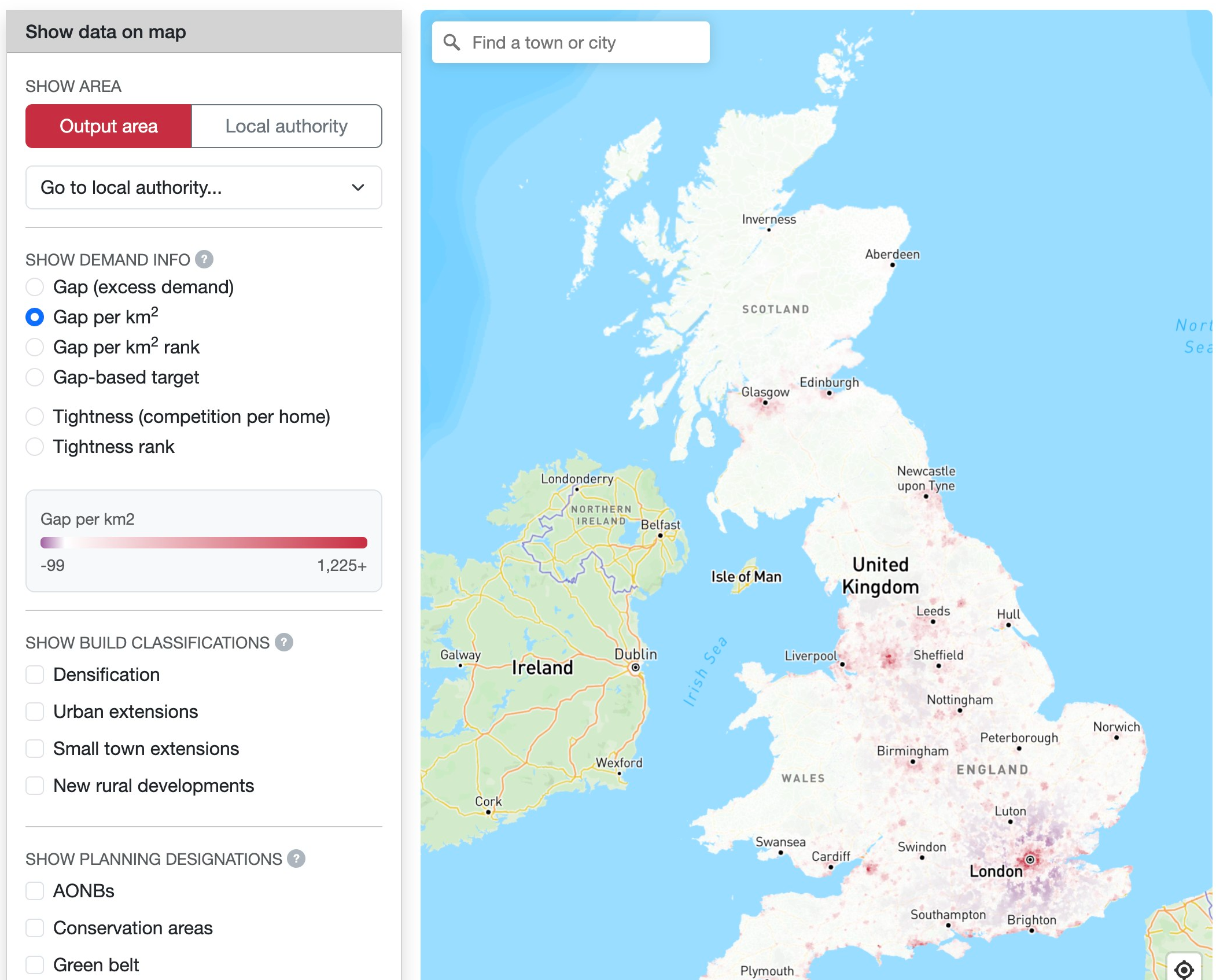
WhereToBuild
University of WarwickThis interactive map is designed to provide evidence on where housing is most needed.
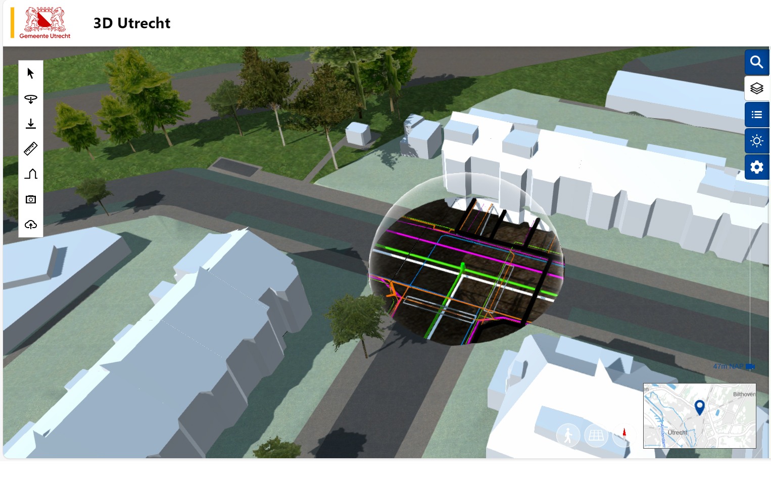
3D Utretcht
UtrechtAn interactive 3D model of everything from buildings and parks to underground infrastructure, used by city officials, researchers, and residents to visualise changes and assess their impact before implementation.
.jpg)
Open Space Sandbox
PhiladelphiaLike a city-building game—but real life. Open Space Sandbox turns play into planning data
Placemaking Europe is a European network that connects practitioners, academics, community leaders, market players and policy makers across the field of placemaking.
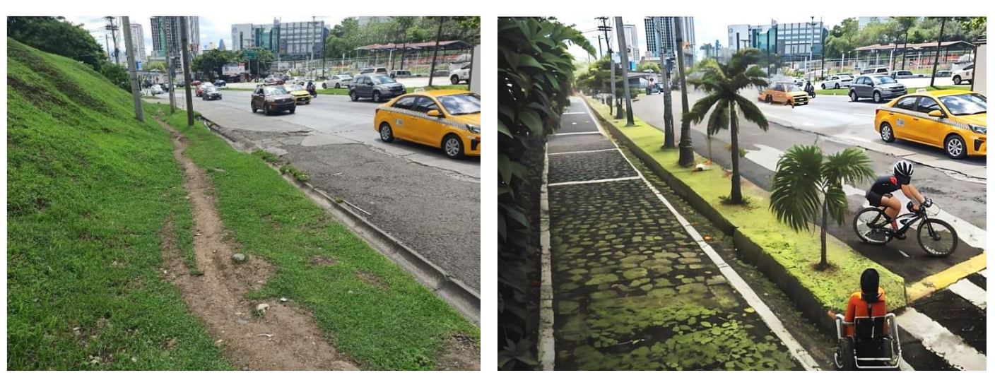
UrbanistAI workshops in Panama City
Panama City, PanamaParticipants worked in mixed-age groups, using UrbanistAI to redesign public spaces based on photographs they had taken themselves.

Blitz helps you automate plan reviews to expedite building permits and approvals for homes, offices and commercial buildings across the USA with our AI-powered pre-check and plan review software.
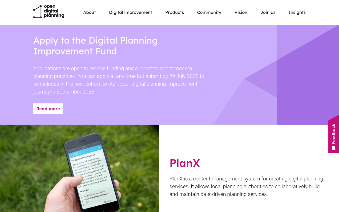
PlanX (Open Digital Planning)
United Kingdom of Great Britain and Northern Ireland 🇬🇧PlanX is a content management system for creating digital planning services. It allows local planning authorities to collaboratively build and maintain data-driven planning services.
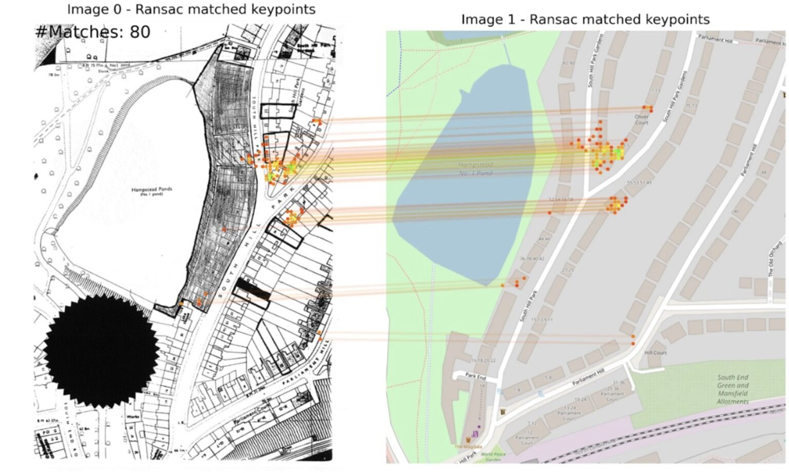
Extract
10 Downing StreetUsing AI to unlock historic planning data
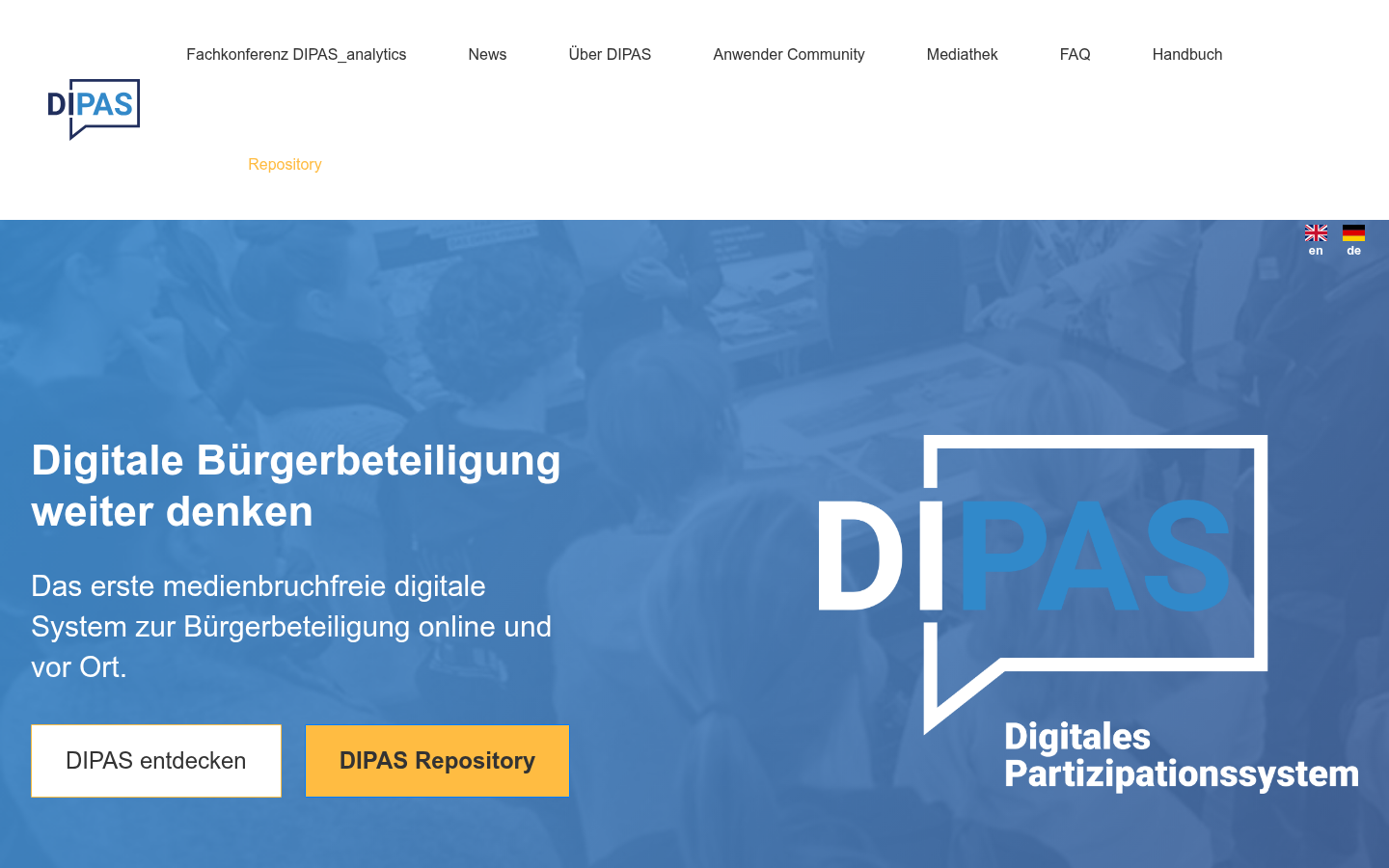
DIPAS
HamburgDas erste medienbruchfreie digitale System zur Bürgerbeteiligung online und vor Ort. DIPAS entdecken DIPAS Repository
Urban In Mind
OntarioUrban in Mind is a trusted urban planning consultant serving the Greater Toronto Area.

+(1).png)
Boston Curb Usage Map
BostonTo solve these challenges, the Streets Cabinet and Innovation and Technology Cabinet are building a digital map of Boston’s complex curb network and regulations.

Streetwise Technology
Surrey, UKPedestrian-first traffic management solutions

Open Digital Planning
United Kingdom of Great Britain and Northern Ireland 🇬🇧A community of forward-thinking Local Planning Authorities working together to shape a more efficient, data-driven planning system.

Levelling-up and Regeneration Act 2023 Bill
United Kingdom of Great Britain and Northern Ireland 🇬🇧Requiring open digitalisation and publication of planning data in the UK

InformedDECISION™
United Kingdom of Great Britain and Northern Ireland 🇬🇧a groundbreaking AI-based decision support platform, which is transforming decision-making processes for planning proposals on sensitive land.

Genie AI
LondonThe Genie AI team has created an easy step-by-step guide which takes you through every aspect of drafting your Section 106 Agreement.

GOV.UK document digitization tool
United Kingdom of Great Britain and Northern Ireland 🇬🇧A new AI tool aims to modernise council planning by replacing outdated paper systems with high-quality digital data, enabling faster, smarter decisions to support the government’s goal of building 1.5 million homes.

Local plan policy tool
LondonLocal plan policy tool

In this paper, we examine how AI could help reimagine local government.

Planning and housing data in England
United Kingdom of Great Britain and Northern Ireland 🇬🇧Official government portal for open planning and housing data

Virtual Bradford
United Kingdom of Great Britain and Northern Ireland 🇬🇧an open digital twin for the City of Bradford

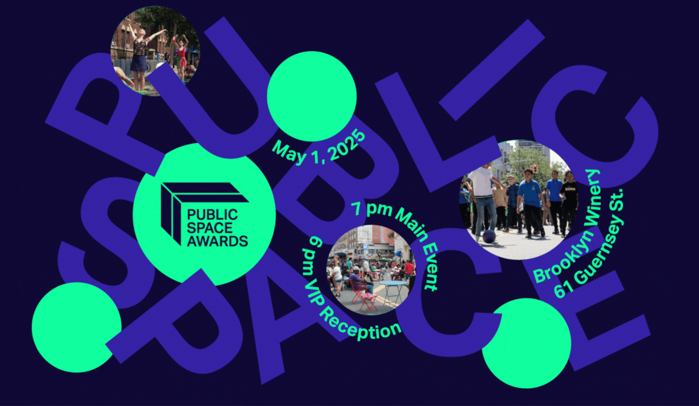
Public Space Awards
BrooklynCome and join the Open Plans community on Thursday, May 1st for a festive celebration of the people behind our city’s defining public spaces.

Hey Neighbour Collective
Burnaby, CanadaHey Neighbour Collective (HNC) is a collective impact project that brings together housing providers, researchers, local and regional governments, housing associations and health authorities to experiment with and learn about ways of effectively building community, social connectedness and resilience in B.C.’s fast-growing vertical communities.
UrbanistAI
EuropeThe platform to reimagine the future of our cities.

GAMA is an easy-to-use open source modeling and simulation environment for creating spatially explicit agent-based simulations.

Diagonal Works
United Kingdom of Great Britain and Northern Ireland 🇬🇧We strive to support the development of more equitable and inclusive places through our belief in open, collaborative and data informed urbanism.

The project will establish a workshop to bring community-centered planning to the emerging technology of autonomous vehicles (AV)

Georeferenced Guassian Splatting for drones to reproduce thin and tricky structures with clarity.

The temporal and spatial intersection of information and telecommunication technologies, creative and knowledge economies, and related new manufacturing systems, has been leading to significant effects on urban socioeconomic and spatial configurations and public policies. Specifically, the post-crisis emergence of innovative workplaces to accommodate these changes, is creating socioeconomic and spatial features that are only recently beginning to be explored in the scholarly literature. According to this scenario, this edited book offers a variety of avenues for exploring the relationships between contemporary production activities and new workplaces in several urban contexts. In particular, it focuses on the consequences of these relationships in terms of regeneration of the urban fabric, as well as on their implication in terms of urban policies. This book represents early observation of the fast-growing phenomenon of new productive activities and workplaces against the background of the gig economy and sharing economy paradigms. Central to this discussion is the investigation of the connection between digital technologies, new works and workplaces, and urban change processes and projects, by providing an additional contribution to new urban agendas for contemporary cities. The chapters originally published as a special issue in the Journal of Urban Technology.

When 'doing ethics' meets public procurement of smart city technology – an Amsterdam case study
Amsterdam[A] multi-stakeholder co-design project – including a citizen panel – is an integral part of the process in which the service is designed and realized

Sidekick
Kansas City, MOIn plain language, tell Sidekick what you want to know and get answers straight from the mySidewalk data library.

The Atlas of Urban Tech
Cornell TechA global atlas of case studies of tech-enabled urban districts and municipal digital masterplans.

Street Activity Sensors
New York City (NYC / New York, NY)8-month pilot to test 12 computer-vision sensors across four boroughs of NYC to employ machine vision and improve street-level data collection and improve planning decisions

The Planning London Datahub
LondonThe Planning DataHub is a collaborative project between all of the Planning Authorities in London to build a single open data set of development proposals in the planning process to enable monitoring of how our City is changing and develop a shared understanding of the data.

UK PlanIt
United Kingdom of Great Britain and Northern Ireland 🇬🇧UK PlanIt is a national aggregator for current and historical planning information.

PlanningAlerts
The OpenAustralia Foundation PO Box 147 Katoomba NSW 2780Find out for free what is being built and knocked down in your area and receive email alerts when something new is planned.

Civic Infrastructure Collaborative drives public value from core urban infrastructure through cross-sector collaboration and technology-enabled innovation.

Citify
Lithuania (Lietuva) 🇱🇹Citify is an online platform designed to track planned and existing real estate projects, ranging from apartment complexes and business centers to streets, bike paths, parks, and schools.

Kur Gyvenu
Lithuania (Lietuva) 🇱🇹It's a platform aimed at helping people find information about various neighborhoods and districts in Lithuanian cities.

Urban Platform
Portugal 🇵🇹A web solution designed for governments that provides the digital twin of the city, and delivers a real-time view of every street, plus insightful analytics to support decision-making and increase the efficiency of the city operations.

Infrastructure Space
Manchester, United KingdomInfrastructure Space was established in 2017 to acknowledge the infrastructural turn in architectural theory, to embrace the thinking and methods established in L+U and [Re_Map] and to explore new territory, specifically the interface between digital communications, infrastructure and the production of space no longer limited to urban contexts, but accepting the often intangible manufactured nature of most British landscapes.

We break the silos of urbanist practices to build Black power and Black joy.

A transportation operating system for orchestrating, governing, and powering modern mobility.
Get email updates
Helpful Links
Reach Out
A project of

With support from
National Endowment for Democracy
Founding Organization
Civic Hall
Technology partner

