Civic Tech Field Guide
Sharing knowledge and productively growing the fieldAdjacent Fields > Tech for public challenges > Disaster response and humanitarian tech - (179)
There's a long tradition of volunteer technologists rallying to aid communities in the aftermath of a disaster or humanitarian crisis. Many of the problems and solutions, such as managing skilled volunteers remotely, apply to other domains in the Civic Tech Field Guide. See also: Participatory Aid.
Showing 179 Results
HalexDream!
Saitama, JapanProviding weather, earthquake, disaster prevention and lifestyle-related information as well as consultation on its usage.
Secure messaging that keeps working when the internet doesn't.
Kahu Ola
HawaiiHawaiʻi civic hazard intelligence platform aggregating real-time wildfire, air quality, weather, and volcanic data from NASA, NOAA, NWS, EPA, and PacIOOS.
Wang Fuk Court Relief Documentation
Hong KongIndependent documentation of relief contributions for families affected by the Wang Fuk Court incident.
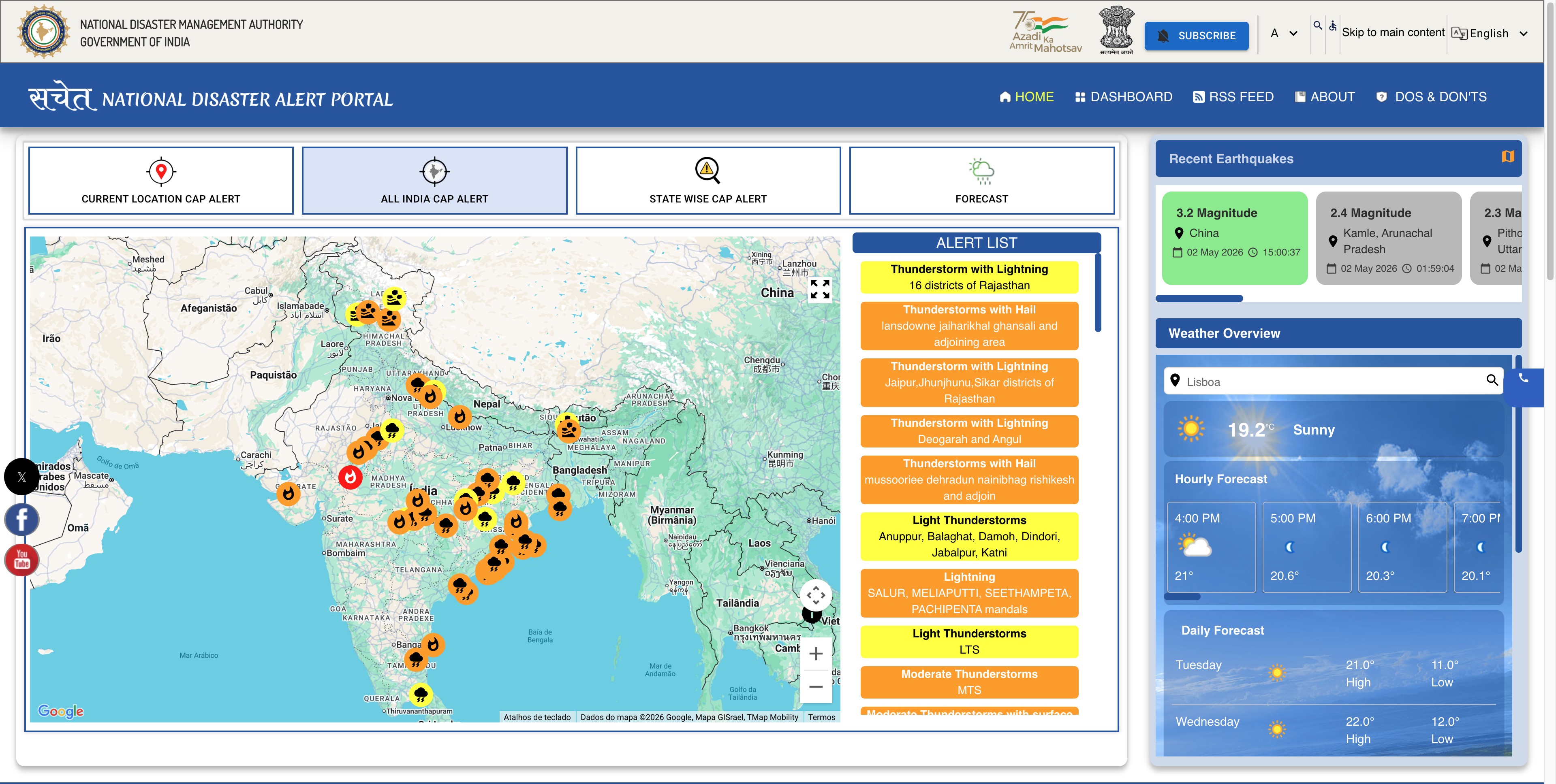
National Disaster Alert Portal (SACHET)
India (Bhārat) 🇮🇳The system has been extensively utilized by disaster management authorities, enabling the dissemination of over 134 billion SMS alerts, till date, in more than 19 Indian languages during natural disasters, weather warnings, and cyclonic events.

FOSS4G is the world's largest conference dedicated to open-source geospatial software, organized by the OSGeo Foundation.
The ICRC, together with The Engine Room and Block Party, produced this report on the uses of messaging apps in humanitarian situations.
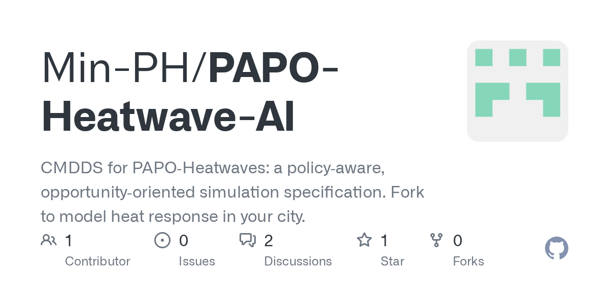
PAPO-Heatwave
Milwaukee, WIPAPO-Heatwave is an open-source conceptual simulation framework designed for AI developers or researchers to develop simulations on heatwave responses.
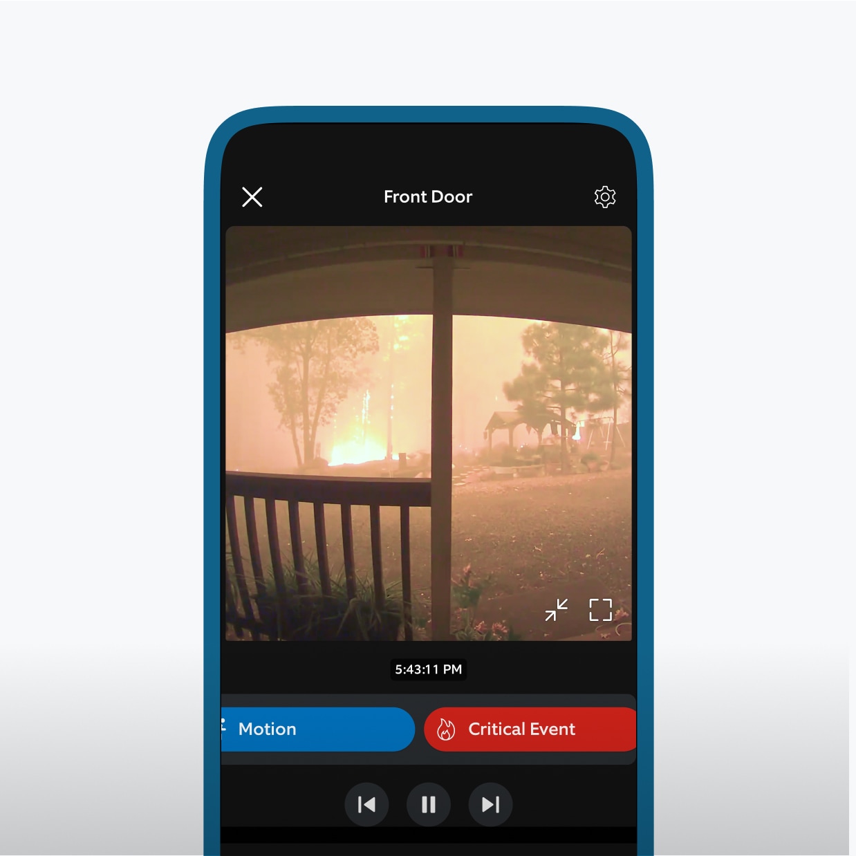
Ring Fire Watch feature
United States of America 🇺🇸Partnership with Watch Duty allows Ring owners to get alerts as well as share wildfire imagery with others
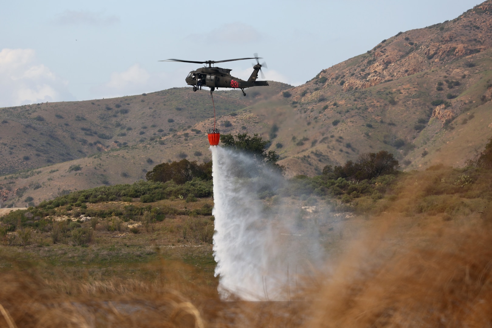
FireGuard Program
Arlington, VAFireGuard uses military satellites with the National Interagency Fire Center, U.S. Forest Service and the National Geospatial-Intelligence Agency’s Firefly capability to detect wildfires, notify authorities, and create products to disseminate to firefighting networks nationwide.
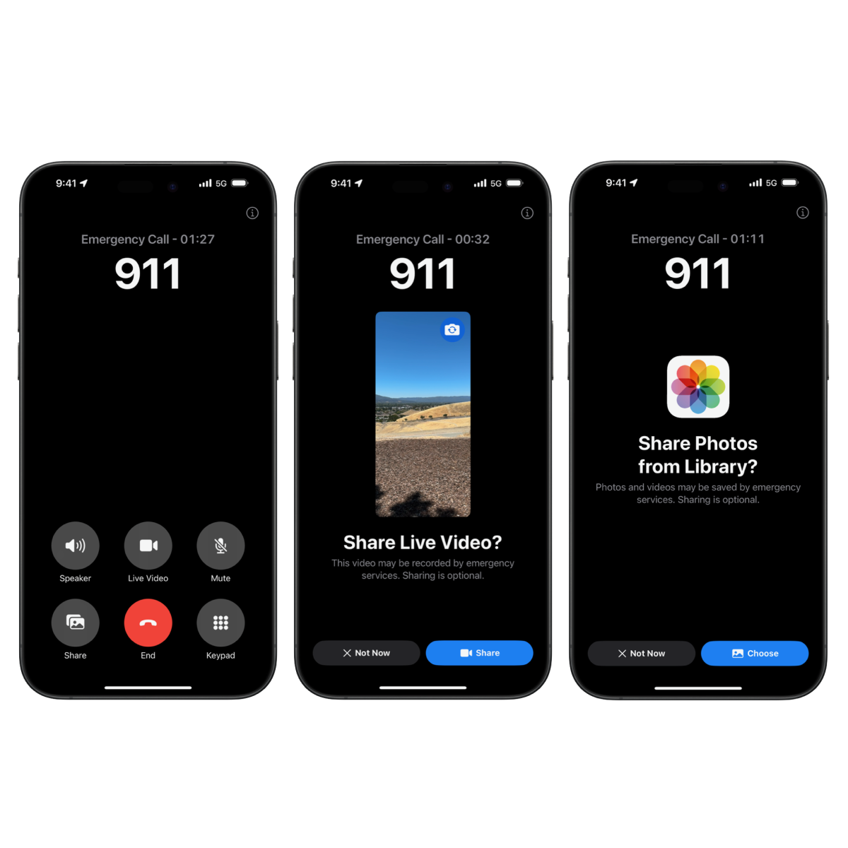
Emergency SOS Live Video allows users to share context through streaming video and recorded media.
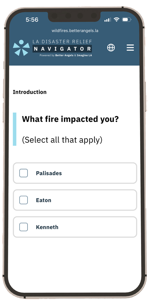
Disaster Navigator
Los AngelesHelping Angelenos After the 2025 Fires. Preparing to Guide Communities Everywhere.
As humanitarian organisations, we often need to share data in order to help households and communities more efficiently and effectively. We developed this Toolkit as a resource to help you and your colleagues to share data responsibly in order to address critical challenges, such as deduplicating data and making referrals.

DeepStateMAP | День 1297
Ukraine (Ukrayina) 🇺🇦Ukrainian government map of the war in Ukraine
Благодійний фонд "DeepStateUA"
Ukraine (Ukrayina) 🇺🇦
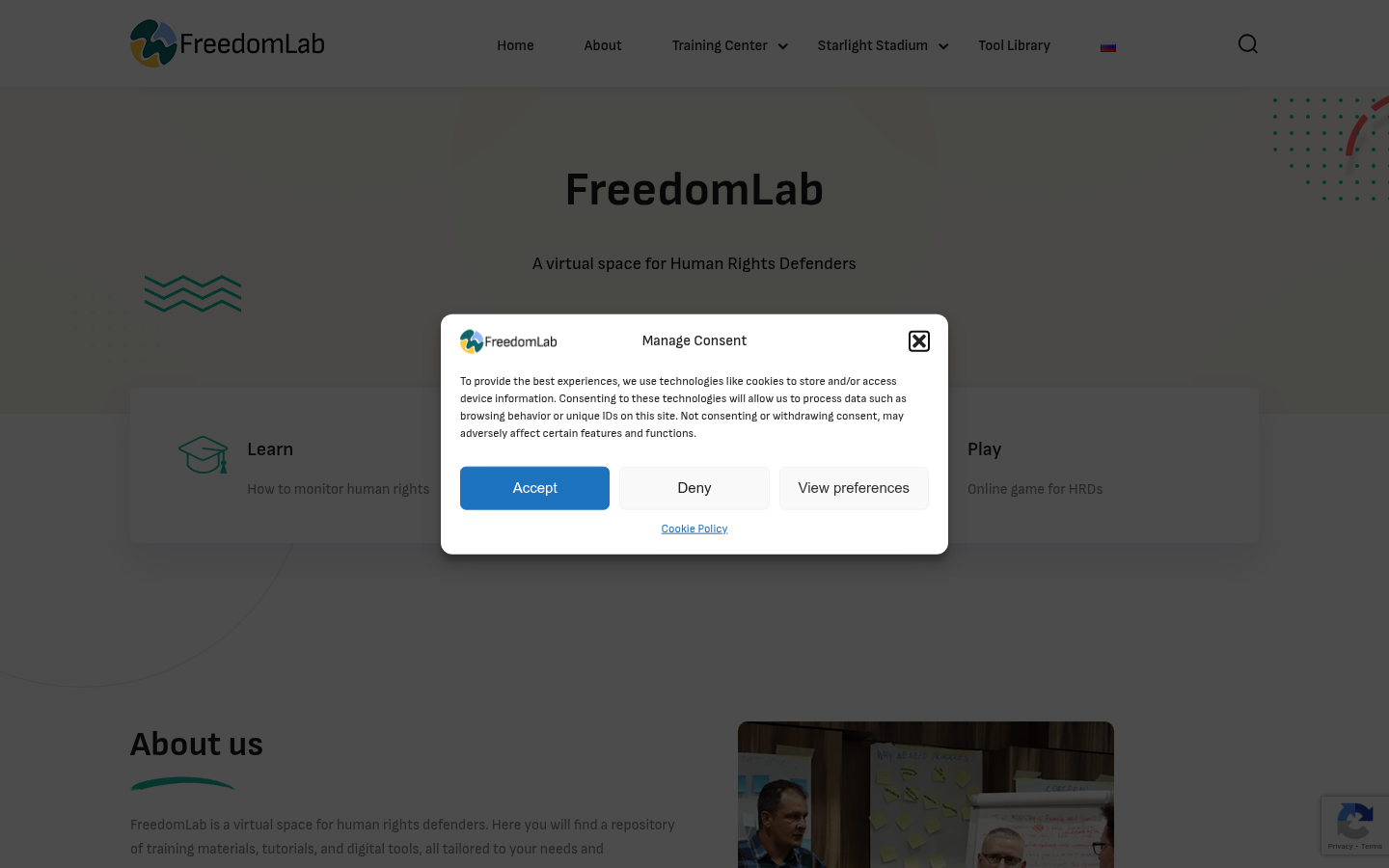
FreedomLab
WarsawA virtual space for Human Rights Defenders
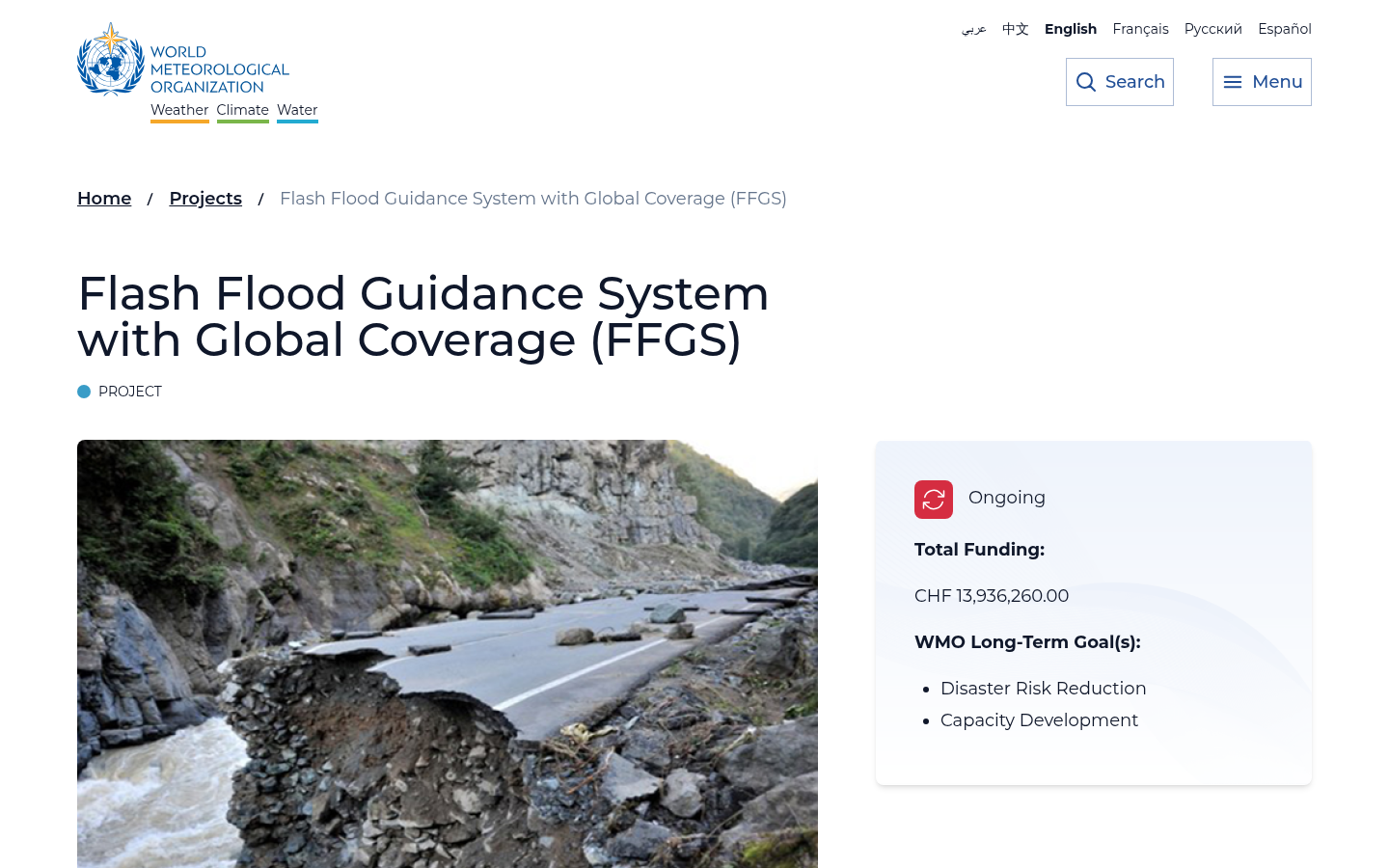
Flash Flood Guidance System with Global Coverage (FFGS)
Washington, DCTo address the issues associated with flash floods, especially the lack of capacity to develop effective flash flood warnings, the Flash Flood Guidance System (FFGS) was designed and developed for interactive use by meteorological and hydrological forecasters throughout the world.

ohsomeNow Stats
HeidelbergohsomeNow Stats is being developed and provided by HeiGIT (Heidelberg Institute for Geoinformation Technology) and offers up-to-date and global scale overview statistics on mapping activity in OpenStreetMap (OSM).

Humanity Crew
European Union (EU)Humanity Crew is a non-profit organization dedicated to ensuring that communities affected by crises receive the critical mental health and psychosocial support they need.

Jangala
United Kingdom of Great Britain and Northern Ireland 🇬🇧Jangala is a technology charity dedicated to providing essential internet access globally, with the goal of connecting 4 million people to the internet by 2030. Founded in 2015 as a volunteer initiative providing Wi-Fi to 5,000 people in the Calais Jungle refugee camp, Jangala offers a unique approach through its novel connectivity solutions, and takes great pride in its strong partnerships with international aid actors, grassroots organisations and public bodies.

pardesi.org.np
South AsiaAn information portal for Nepalese migrants to bridge the gap in their access to information.

Phone Credits for Refugees (PC4R)
United Kingdom of Great Britain and Northern Ireland 🇬🇧PC4R was set up in February 2016 by James Pearce as a way to provide phone credits to people in refugee camps.

Watch The Med
European Union (EU)Watch The Med is an online mapping platform to monitor the deaths and violations of migrants’ rights at the maritime borders of the EU. The WatchTheMed project was initiated as part of the 2012 Boats4People campaign in the Central Mediterranean. Today the project further involves a wide network of organisations, activists and researchers. Through the transnational cooperation with migrants’ rights organisations, activists, researchers, migrants, seafarers active in, around and beyond the Mediterranean and the use of new mapping technologies, WatchTheMed aims to document the deaths and violations that are the structural product of the militarized Southern European border regime. The online map allows to spatialise incidents across the complex legal and political geography of the Mediterranean Sea. Through the accounts of survivors and witnesses, but also the analysis of ocean currents, winds, mobile phone data and satellite imagery, it is possible to determine in which Search and Rescue zone, jurisdictions and operational areas an incident occurred – as well as showing other boats who were in the vicinity of those in distress. Spatialising such information is essential to determine responsibility for violations at sea. Apart from reconstructing past events, the participatory nature of the platform allows many different actors to to indicate ongoing situations of distress. The documentation generated by WatchTheMed seeks to support the work of organisations that defend migrants’ rights, inform migrants of their rights and security at sea, pressure authorities into respecting their obligations at sea, support the ongoing campaigns by the relatives of the dead and disappeared at sea, and support legal proceedings against those who violated the rights of migrants.

Talent Beyond Boundaries (TBB)
United States of America 🇺🇸The organisation focuses on making skilled migration systems for refugees more accessible, and to create a world where displaced people can safely migrate for work, using their skills to rebuild their lives with dignity and purpose. It also collaborates with governments to achieve its purpose.

Pontem Pro
European Union (EU)Pontem Pro closes learning gaps and makes the German education system more accessible, understandable and feasible for migrants - for better education, integration and career opportunities.

Refugees Welcome International
European Union (EU)The Refugees Welcome International network is united by its shared mission to provide private accommodations for refugees all over the world, with the aims of fostering exchange between refugees and locals, combatting discrimination and prejudice, and supporting refugees and asylum seekers in the establishment of local social networks.

Paper Airplanes
United States of America 🇺🇸Paper Airplanes is a non-profit that seeks to prepare university students in conflict zones to be able to finish their university degrees through English language programs, among other initiatives.

Refugee Phrasebook
European Union (EU)The Refugee Phrasebook is a multilingual tool that provides basic useful vocabulary related to the most common immediate needs. It is an open collaborative project that assembles important phrases from various fields, building a collection of useful words and phrases for refugees who just arrived.

Contratados.org
Mexico City, CDMX, MexicoContratados.org allows workers to share their experiences and write reviews about their recruiters and employers in order to make the recruitment process transparent and generate a mechanism for accountability for compliance or non-compliance with the obligations of employers and/or recruiters.

Children On The Edge
United Kingdom of Great Britain and Northern Ireland 🇬🇧Children on the Edge is a child rights organisation created to support the world’s most marginalised children, living in some of the toughest situations. We currently work with more than 20,000 children in Bangladesh, India, Uganda, Myanmar, and Lebanon.

Refugee Info
European Union (EU)Refugee Info is a European information service for refugees, migrants, and asylum-seekers.

Re:Match
European Union (EU)Developing and applying a preference-based algorithm that brings together welcoming cities and people seeking protection, Re:Match aims to bring just, sustainable and human-rights centered innovation to the field of migration governance.

Fugees Family
United States of America 🇺🇸Fugees Family is a national nonprofit organization that partners with public school districts and communities to better serve refugee and immigrant students. Fugees is reimagining the ways educators connect with newcomer students

Project Dastaan
United Kingdom of Great Britain and Northern Ireland 🇬🇧Project Dastaan is a peace-building initiative which examines the human impact of global migration through the lens of the largest forced migration in recorded history, the 1947 Partition of India and Pakistan.

Berlin Mondiale
BerlinTo make arts and culture more visible and accessible to people in outskirt neighborhoods of Berlin, particularly those with migration, asylum, and exile histories.

FindHello
United States of America 🇺🇸FindHello is an app built in partnership with the UNHCR by USAHello, a non-profit organization that uses technology to connect immigrant communities with the information and resources they need to thrive. It seeks to target refugees who migrate to the USA.

Humans In The Loop
European Union (EU)Our goal is to provide digital work and training opportunities in some of the areas of the world which are hit hardest by armed conflict and forced displacement. We recognize the complexity of working in such fragile contexts and in order to navigate the challenges around employing and paying people in these locations, we partner with a network of established local organizations with a proven track record.

GeoMatch
United States of America 🇺🇸GeoMatch works in many settings, from refugee resettlement to immigration agencies and nonprofits that help aspiring immigrants. They tailor the software to the client’s needs.

The Refugee Buddy Project
United Kingdom of Great Britain and Northern Ireland 🇬🇧A community group led by migrants and refugees formed in 2017, to provides support in the form of buddies, advocacy, financial and emotional support for refugees seeking safety in Scotland (specifically Hastings, Rother, and Wealden).

NaTakallam
United States of America 🇺🇸NaTakallam leverages the freelance digital economy to provide income to refugees, displaced persons & their host community members, by hiring them as online tutors, teachers, translators & cultural exchange partners, regardless of their location & status.

OCHA carried out two global survey to assess the consequences of the US funding freeze on humanitarian action globally. The first round, in February, looked at the impact of the suspension orders and waivers. The second was launched in March following the announcement of the US grants’ termination, in collaboration with IOM, UNHCR and ICVA.


Humanitarian Action provides a comprehensive overview of the humanitarian landscape by providing both an annual snapshot complemented by analysis, and live data on on humanitarian crises and response.

Engineers Without Borders International (EWB-I)
Boulder, COWe’re on a mission to mobilise a global network of engineers for good.

Norwegian Church Aid, with the support of Innovation Norway, is working on the design of a digital “meeting place” for communities at risk of violence to talk safely about needs, priorities, and aspirations.

Data Entry and Exploration Platform (DEEP)
Williamsburg, VAA collaborative analysis platform for effective aid response
Get email updates
Helpful Links
Reach Out
A project of

With support from
National Endowment for Democracy
Founding Organization
Civic Hall
Technology partner

