Civic Tech Field Guide
Sharing knowledge and productively growing the fieldTag: Political unit > city - (239)
Showing 239 Results

Chicago IT Strategy
Chicago, ILTechnology plan for the City of Chicago

Spatial Equity NYC
Massachusetts Institute of Technology (MIT)Spatial Equity NYC (SE), a tool developed by MIT’s Norman B. Leventhal Center for Advanced Urbanism (LCAU) in close collaboration with New York City-based nonprofit Transportation Alternatives (TA), visualizes mobility, environment, and health data.

Riding Forward: Overhauling Citi Bike’s Contract for Better, More Equitable Service
New York City Council, Broadway, New York, NY, USAThis report reviews Citi Bike’s performance to-date and recommends a comprehensive contract overhaul to ensure more reliable and equitable service, with a strategic mix of performance standards, attention to equitable service, and incentives to enable Citi Bike to thrive as a key element of the transportation network – whether under Lyft or a new operator.

NYC Smart City Testbed
New York CityThe NYC Smart City Testbed Program is inspiring innovation within City government by streamlining and accelerating the citywide process for piloting emerging technologies.

Primary Land Use Tax Lot Output (PLUTO)
New York CityExtensive land use and geographic data at the tax lot level in comma–separated values (CSV) file format. The PLUTO files contain more than seventy fields derived from data maintained by city agencies.

Air Quality Improvement and Monitoring
New York City6-month pilot of three pole-mounted static air quality machines

CoreData.nyc is New York City’s housing and neighborhoods data hub, presented by the NYU Furman Center.

Street Activity Sensors
New York City8-month pilot to test 12 computer-vision sensors across four boroughs of NYC to employ machine vision and improve street-level data collection and improve planning decisions
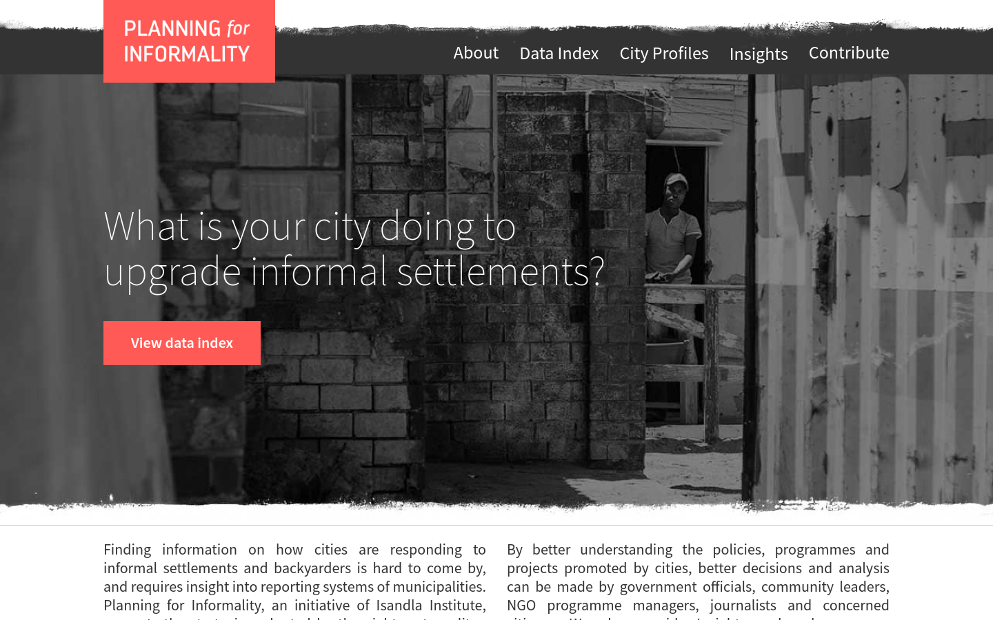
Planning for Informality
South Africa (South Africa, Afrika-Borwa, Suid-Afrika)What is your city doing to upgrade informal settlements?

Equitable Community Engagement Toolkit
PhiladelphiaThe City of Philadelphia aims to improve collaboration with communities. This website shares guidance on how to engage communities equitably.

citymeetings.nyc
New York CityA tool that makes it easy to navigate and research government meetings. It uses LLMs to create granular chapters that readers can skim and share.
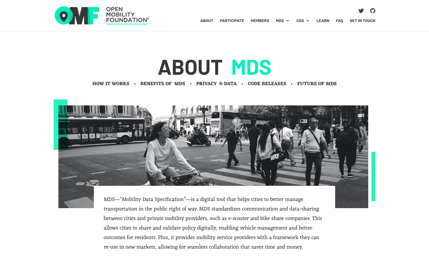
Mobility Data Specification (MDS)
United States of America (the)MDS standardizes communication and data-sharing between cities and private mobility providers, such as e-scooter and bike-share companies.

City-Level Decision-Making Tool
Orlando, Florida, USAThe Society Library (a collective intelligence institute) shared their micro-voting decision-making tool for city-level decision-making.

Unboxed City
Massachusetts Institute of Technology (MIT)Art exhibition at MIT: critical explorations of ai and cities

digitalhelpdeskforcities.org is a platform for public officials, specialists, collaborators, and organisations globally who want to promote an inclusive and democratic development of new technologies in their cities.

Laboratorio GovTech LATAM
ColombiaUna plataforma de innovación abierta que permite acercar nuevas soluciones digitales a los grandes retos de los municipios participantes.

Global Observatory of Urban Artificial Intelligence
Barcelona, SpainIts goal is to promote research and disseminate best practice in the ethical application of artificial intelligence in cities.

City AI Connect
Johns Hopkins UniversityA global community for cities to learn about generative AI together, faster.

Boti
Buenos AiresEl chatbot de la Ciudad Buenos Aires
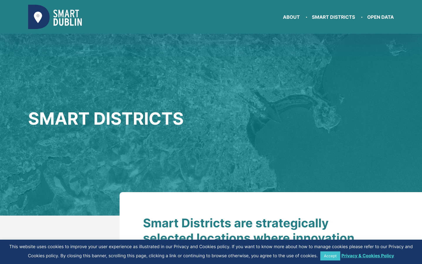
Smart Districts
Dublin, IrelandSmart Districts (Dublin) are strategically selected locations where innovation projects are fast-tracked.

Cycling updates to Google Maps now take account of traffic conditions and the availability of high-quality cycling infrastructure

Internet of Things pilots to improve quality of life in London neighborhoods

The Planning London Datahub
LondonThe Planning DataHub is a collaborative project between all of the Planning Authorities in London to build a single open data set of development proposals in the planning process to enable monitoring of how our City is changing and develop a shared understanding of the data.
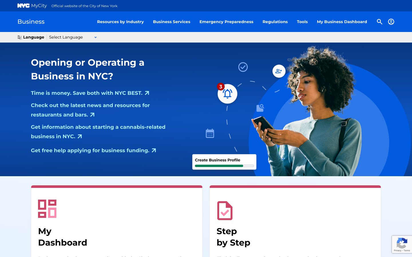
MyCity Chatbot
New York City, NY, USANYC's Business Services Chatbot which "uses Microsoft's Azure AI services to provide information in response to questions you have about starting or operating your business" in ten+ languages

Camden Talks Data: Machine learning
Camden Town, LondonThis video explains how Camden Council uses machine learning to improve council services.

Nordic Smart City Network
EuropeThe Nordic Smart City Network is a collaboration initiative joining five Nordic countries, and currently 20 Nordic cities with a common goal: to explore the Nordic way to create livable and sustainable cities.

BLOXHUB
CopenhagenBLOXHUB is the Nordic Hub for Sustainable Urbanization.

DOLL Living Lab
CopenhagenOur expansive 1.5 km2 industrial area, frequented by over 10,000 daily users, functions as a vibrant physical testing space of smart city environments – now also offering a real-world platform with a digital twin for urban innovation at a 1:1 scale.

Copenhagen Solutions Lab
CopenhagenAt Copenhagen Solutions Lab, we support the development of the city through testing and implementation of intelligent and data-driven solutions, that support the needs of the city and its citizens.

District Civic Labs
Washington, DCCivic innovation & equality in DC

Urban Analyst provides interactive maps of the properties of cities including of their transport systems and socio-demographic conditions, as well as statistical summaries of all cities.

NYC Street Map
New York City, NY, USANYC Street Map is an ongoing effort to digitize official street records, bring them together with other street information, and make them easily accessible to the public.

Water Data Explorer
LondonThe Water Data Explorer was developed by the British Geological Survey in collaboration with Imperial College London, The University of Oxford and UCL as part of the CAMELLIA project, and in partnership with a broad range of stakeholders. CAMELLIA has been funded by the UKRI's Natural Environment Research Council (NERC).

Civic Infrastructure Collaborative
Chicago, ILCivic Infrastructure Collaborative drives public value from core urban infrastructure through cross-sector collaboration and technology-enabled innovation.
Tow Zone Alerts
Boston, MAWe help people avoid getting ticketed and towed when they park on the street through simple SMS alerts.

Engaged Cities is a community of practice for news organizations with engagement-first approaches to serving U.S. cities.

Kur Gyvenu
Lithuania (Lietuva)It's a platform aimed at helping people find information about various neighborhoods and districts in Lithuanian cities.

Citify
Lithuania (Lietuva)Citify is an online platform designed to track planned and existing real estate projects, ranging from apartment complexes and business centers to streets, bike paths, parks, and schools.

Open Vilnius
Vilnius, LithuaniaThe Innovation and Technology Group of the Vilnius City Municipality is developing digital innovations aimed at the smart development of the Lithuanian capital.

Dalyvauk! Vilnius
Lithuania (Lietuva)This platform helps municipality facilitate participatory budgeting in the municipality.

Dalyvauk! Anykščiai
Lithuania (Lietuva)This platform helps municipality facilitate participatory budgeting in the municipality.

Dalyvauk! Klaipėda
Lithuania (Lietuva)This platform helps municipality facilitate participatory budgeting in the municipality.

Tvarkau miestą
Lithuania (Lietuva)It is a platform aimed at improving the urban environment and public spaces in Lithuanian cities.

Consorcio Internacional de Localidades en Acción (CILA)
Latin AmericaUn consorcio de organizaciones de la sociedad civil conformado por Asuntos del Sur, Fundación Ciudadanía Inteligente, Extituto de Política Abierta e Instituto Pro Comum quienes tienen como misión conjunta impulsar formas innovadoras de gobernanza y acción colectiva en Ciudades del Sur Global.

Public Option for AI (PO4AI) is an immersive experience designed for elected officials and city staff to explore how residents’ voices might be centered in decision-making around public-interest technologies.

C² Challenge
DenverThe C² Challenge provides an open-ended innovation process for government procurement that removes the need to meet specific requirements and provides an open door to business and academic innovators to propose new ways of solving a problem.

District 33 Street Tree Stewardship Map
Brooklyn, NYThis map will help us grow volunteer engagement at a neighborhood level and track our progress towards increasing tree stewardship across District 33 (in New York City)

Seattle By Design
Seattle, WA, United States of AmericaA pilot program that connected a cohort of volunteer experts with City staff to answer questions and make recommendations using best practices in user research. Seattle By Design is a partnership between U.S Digital Response (USDR) and Seattle Innovation & Performance.

Municipalism Cohort Fellowship
Los Angeles, CAThe Municipalism Cohort Fellowship is a 12-week online program, beginning on September 16th 2023 and ending December 2nd, that presents radical municipalist theory and practice to grassroots organizers trying to reclaim the right to their cities and self-organize as rebel cities.

UN HABITAT Digital Cities Toolkit
58 Victoria EmbankmentAn open source Policy Toolkit for cities to develop digital policies that put citizens at the center, tackle Sustainable Development Goals and make Governments more open, transparent, and collaborative.
Get email updates
Helpful Links
Reach Out
A project of

With support from
National Endowment for Democracy
Founding Organization
Civic Hall
Technology partner

 Civic Tech Field Guide