Civic Tech Field Guide
Sharing knowledge and productively growing the fieldSearch Results - map (656)
Showing 656 Results

Mapping Civic Education in Europe
Bonn, GermanyOur Mapping Civic Education in Europe programme is a dynamic initiative continuously evolving by adding new countries to the first-ever pan-European virtual map of civic educators.


Mapas Culturais
Brasília - Brasilia, Federal District, BrazilMapas Culturais é uma plataforma colaborativa que reúne informações sobre agentes, espaços, eventos e projetos culturais, fornecendo ao poder público uma radiografia da área de cultura e ao cidadão um mapa de espaços e eventos culturais da região
Access street-level imagery and map data from all over the world. Fill in the gaps by capturing coverage yourself.

Swipe and tap. Put communities on the map. Help humanitarians find and help vulnerable people.

MapRoulette has dozens of mapping Challenges that are created by experienced mappers. Each Challenge is about improving OSM in one very specific way

Mapeo is a free, easy-to-use, open source set of tools for collecting and mapping information. Mapeo was built by Digital Democracy with and for earth defenders to easily document environmental & human rights information and to collect data about their land. It was designed to work in entirely offline environments, is highly customizable, and built on a decentralized peer-to-peer database that allows communities to own their own data.
This book provides a sophisticated and nuanced analysis of the role of mapping in contemporary global governance, and will be of interest to students and researchers within politics, geography, sociology, media, and digital culture and

But deliberative empirical research has its own problems

Mapolitic
United Kingdom of Great Britain and Northern Ireland (the)A way for the public to gain the very basic (and essential) knowledge about their elected representatives.
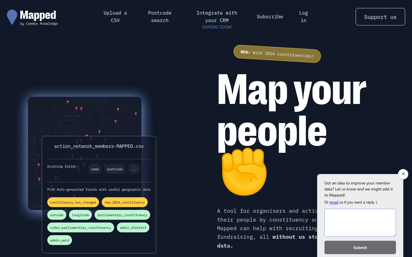
Mapped
United Kingdom of Great Britain and Northern Ireland (the)Mapped integrates with common organising platforms like Airtable, Mailchimp and Action Network to augment membership lists with other useful data sources.

Mapatón Ciudadano
XalapaMapeo de rutas para futuras ciudades sostenibles

Exposing protection gaps in digital transformation programmes

MapIt
United Kingdom of Great Britain and Northern Ireland (the)The easy way to match points to boundaries


MAPLE makes it easy for anyone to view and submit testimony to the Massachusetts Legislature about the bills that will shape our future.

Mapping the global behavioural insights community
Paris, FranceTo highlight the global knowledge base of behavioural insights work in public policy, and bring the achievements of institutions to the fore, the OECD launched the Behavioural Insights Knowledge Hub and map in 2021.

Mapping Healthy Digital Public Spaces
New York City, NY, USAWe are identifying the organizations and leaders creating digital community-building platforms that strengthen our democracy.

Mapping NGOs Repairs
Raymond Ghosn Building, American University of Beirut, Maroun Semaan Faculty of Engineering and Architecture PO Box. 11-0236 Riad El Solh 1107 2020, Beirut LebanonBetween March and September 2021, BUL researchers identified around 80 NGOs that participated in shelter repair within the neighborhoods severely affected by the August 2020 port blast. The data and findings are presented through a recent mapping output on the Beirut Urban Observatory.

Mapeo de tecnología cívica en América Latina
Rincón 477 Of.803 CP.11000 Montevideo Uruguayby Silvana Fumega y Fabrizio Scrollini

Mapping videos of the capitol seige
Capitol HillMapping the videos of the US Capitol building attack

Map Kibera
NairobiKibera in Nairobi, Kenya, was a blank spot on the map until November 2009, when young Kiberans created the first free and open digital map of their own community. Map Kibera has now grown into a complete interactive community information project. We

Mapotic
Czech Republic (Ceska Republika)Work with maps like never before. Build your structure, visualise data and let people interact. Use maps to get you mission fullfiled.

MapTable
Netherlands (Nederland, Holland)A hardware table that lets people gather around it for collective decision-making processes

Maptionnaire Community Engagement Platform
Finland, Helsinki 00100, Fredrikinkatu 55aDigital heart for building cities together

Mapping Makoko
NigeriaA combined tech and journalistic effort to map the Makoko informal settlement

Mapping LA
Los Angeles, CAThis regional view is your portal to individual maps and statistics for 158 cities and unincorporated places and 114 neighborhoods within the city of Los Angeles.


An open source mapping platform for custom designed maps. Our APIs and SDKs are the building blocks to integrate location into any mobile or web app.

Maps for Change
San FranciscoEmbeddable map of parallel events and buses going to the People's Climate March in Washington, DC.

A blog post covering ways to map the media ecosystem

MapLight is a nonpartisan, 501(c)(3) nonprofit organization that reveals the influence of money in politics, informs and empowers voters, and advances reforms that promote a more responsive democracy.

MapChecking calculates the size of an area, and then calculates how many people may be standing in it - based on how thick the crowd is.
MapaTanda
12 Makadios, Diliman, Quezon City, Metro Manila, PhilippinesMapping with and for the Older Adults (Senior Citizens) and Ageing Population in the Philippines

MapAction
Oxfordshire, UKAn emergency map publishing system that supports humanitarian workers in the field

Mapa da Inovação Política
Brazil (Brasil)The largest and most extensive mapping of emerging political practices in Latin America.

The Ability Programme exists to advocate for the rights of Persons With Disabilities (PWDs) in line with the UN Convention on the Rights of Persons with Disabilities (CRPD), as well as SDGs 10 and 11

MAPSCorps
Chicago, ILWe train youth to produce high quality data about community assets that everyone can use to improve the human condition.


MapIt UK
United Kingdom of Great Britain and Northern Ireland (the)If you have a Excel, CSV, or OpenDocument file including a column of postcodes, upload it here, and MapIt will automatically match the postcodes and add columns for the administrative areas (councils, constituencies, CCGs, etc.) you request, sending you the results by email.
Humanitarian OpenStreetMap Team (HOT)
United States of America (the)HOT is an international team dedicated to humanitarian action and community development through open mapping. They work together to create open map data which revolutionises disaster management by enabling disaster responders to reach those in need, and contributes to achievement of the Sustainable Development Goals.

OpenGroupMap is an open platform for creating and sharing collaborative maps. It enables communities, groups, and organizations to build shared geographic knowledge bases.
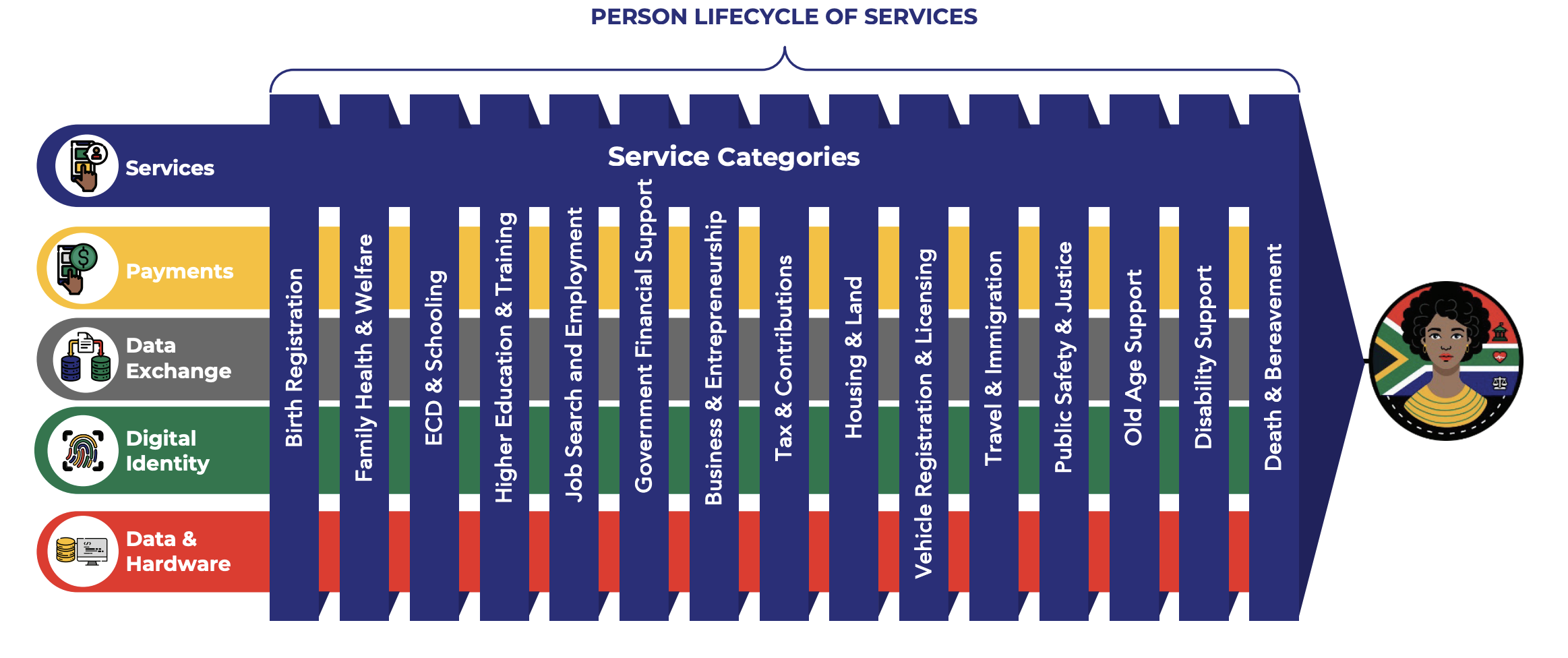
South Africa’s Roadmap For The Digital Transformation Of Government
South Africa (South Africa, Afrika-Borwa, Suid-Afrika)The Roadmap for the Digital Transformation of the South African Government addresses the urgent need for a transformative shift in governmental operations
Get email updates
Helpful Links
Reach Out
A project of

With support from
National Endowment for Democracy
Founding Organization
Civic Hall
Technology partner

 Civic Tech Field Guide