Civic Tech Field Guide
Sharing knowledge and productively growing the fieldSearch Results - civic (2349)
Showing 2349 Results

mxDistritos
Mexico City, CDMX, MexicoThe repository contains maps of Mexican districts used to elect representatives to various offices and code for data systematization and analysis. The primary source are shapefiles publicly distributed by INE (formerly IFE, Mexico's national election board, page here). Data in this repo is prepared for mapping and statistical analysis.
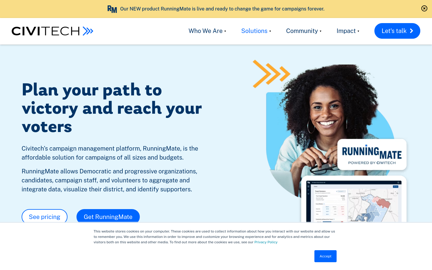
Civitech’s campaign management platform, RunningMate, is the affordable solution for campaigns of all sizes and budgets.

An affordable voter file perfect for civic engagement and grassroots organizing

Common Crawl maintains a free, open repository of web crawl data that can be used by anyone.

Bangladesh Open Innovation Lab (BOIL)
Dhaka, BangladeshOur aim is to build a community that supports the Open Data and uptake of the Living Lab paradigm.

Open candidate information for UK elections covering all 2,015 areas


We created Athenian Project to ensure that state and local governments have the highest level of protection and reliability for free, so that their constituents have access to election information and voter registration.

This database by Mozilla Foundation maps intersections between the key social justice and human rights areas of our time and documented AI impacts and their manifestations in society.
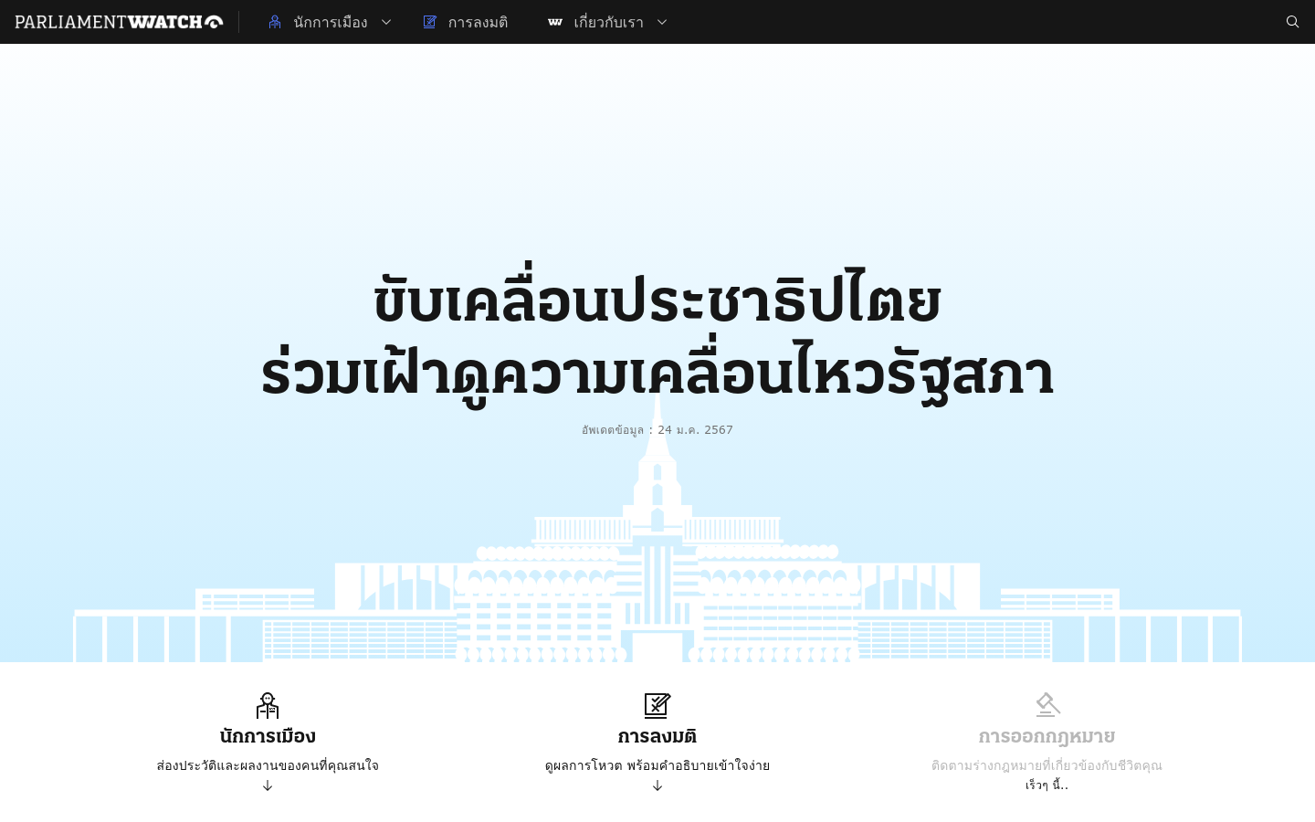
Parliament Watch (Thailand)
Bangkok, ThailandAn open-source comprehensive platform that serves as a one-stop solution for monitoring Thailand's parliament.

Recognizing organizations that support politicians to empower citizens and develop better policies for people and the planet.

Use the Guide Finder to explore proposed approaches to common data for social impact challenges.

FCA Digital Sandbox
LondonThe Digital Sandbox offers General Data Protection Regulation (GDPR) compliant datasets in a secure environment, mentorship from industry experts and access to the FinTech Community to help enable experimentation and scaling for proof of concepts.

By Aure Schrock. Out in September. The first detailed history of Code for America that examines how democratically designed government systems can collectively improve technology's impact on society.

Vote Report India
India (Bhārat)Ushahidi-powered project tracking voting irregularities in the 2009 Indian election

We are a non-profit that partners with state criminal justice agencies to advance their use of data and reduce incarceration.

Spatial Equity NYC
Massachusetts Institute of Technology (MIT)Spatial Equity NYC (SE), a tool developed by MIT’s Norman B. Leventhal Center for Advanced Urbanism (LCAU) in close collaboration with New York City-based nonprofit Transportation Alternatives (TA), visualizes mobility, environment, and health data.

Riding Forward: Overhauling Citi Bike’s Contract for Better, More Equitable Service
New York City Council, Broadway, New York, NY, USAThis report reviews Citi Bike’s performance to-date and recommends a comprehensive contract overhaul to ensure more reliable and equitable service, with a strategic mix of performance standards, attention to equitable service, and incentives to enable Citi Bike to thrive as a key element of the transportation network – whether under Lyft or a new operator.

FPWA’s NYC Funds Tracker monitors New York City’s revenue and the flow to budget expenditures.

This programme will support 100 people to become Everyday Democracy Champions, in turn catalysing the action of others in communities furthest from power, and creating tangible change across all four UK nations.

TransparencIT
NigeriaWe are a civic tech organization fostering courtroom openness, social justice and citizen engagement in Nigeria.

Digital Rogue Society Experiment Group
Ethiopia (Ityop'iya)Civil society organization craving for improved government, political parties, CSOs and businesses accountability with the introduction of reliable and innovative civic engagement solutions.
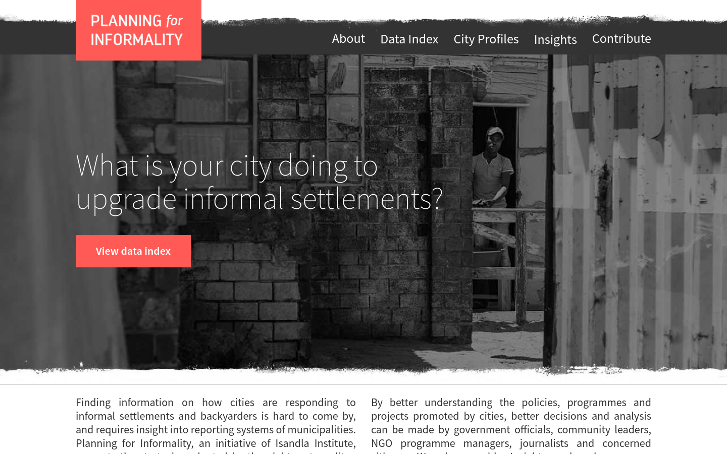
Planning for Informality
South Africa (South Africa, Afrika-Borwa, Suid-Afrika)What is your city doing to upgrade informal settlements?

Highlighting modernization initiatives from legislatures around the world

Digital Fundamentals for Public Impact
Georgetown University, 3700 O St NW, Washington, DC 20057, United StatesOnline course offered through Georgetown University’s Initiative on Technology and Society, the Beeck Center for Social Impact + Innovation and the McCourt School of Public Policy: a continuing education course to help participants rapidly grasp digital fundamentals in a way that is practical and relevant to their work.

Starting in the fall of 2023, this fellowship will empower student athletes from across the country to strengthen non-partisan civic participation on their teams, on their campuses, and in their broader communities.

The Global Innovations in Democracy: Parliamentary Exchange
Washington, DCThe Global Innovations in Democracy: Parliamentary Exchange (GID), led by the Institute for Democratic Engagement and Accountability (IDEA) at The Ohio State University, and the Center for Democracy Innovation (now part of the National Civic League), was established in 2022 to provide a global forum for legislators to discuss the most innovative methods and tools for gathering input, overcoming divisions, building trust, and gaining public support for public policy.

The Digital Impact Exchange
United Nations FoundationIt can be tough for government decision makers to find current, reliable information on tried-and-tested technologies. The Exchange solves that problem by serving as a one-stop shop, featuring over 500 digital tools, products and opportunities for government technology decision makers, IT developers, and product vendors.

Climate Data Joint Learning Network
United Nations FoundationThe Climate Data JLN will surface key data governance innovations that will enable climate-relevant data to be more accessible and useful for frontline governments and communities.

Design Action Research with Government
1 City Hall Square, Boston, MA, United StatesDesign Action Research with Government (DARG) is a guide for creating civic innovation projects.

Common Knowledge
LondonWe use technology to help social movements build power
![Is your [UK] council fuelling the climate crisis?](https://s3.us-east-1.amazonaws.com/ctfg-airtable/screenshots/rec2opTaK3Yl8q3aE/httpsplatformlondonorgisyourcoun)
Divestment campaign targeting local councils investing in fossil fuel companies
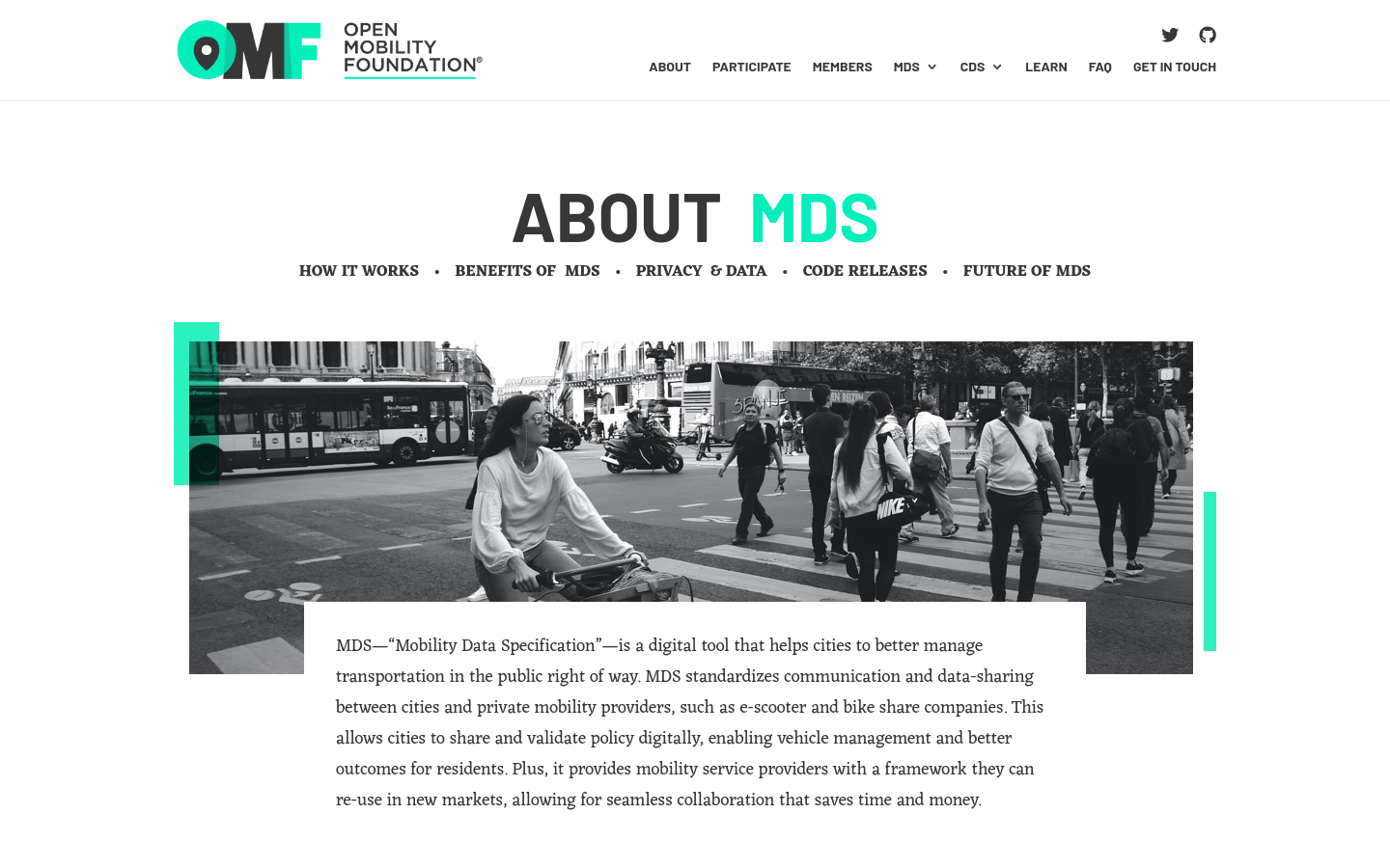
Mobility Data Specification (MDS)
United States of America (the)MDS standardizes communication and data-sharing between cities and private mobility providers, such as e-scooter and bike-share companies.

Comunitatea Funky Citizens
RomaniaAn 2024 election info hub and civic caravan for Romanian citizens

PoliDashboard
TorontoAn app for tracking political advertisements on Meta-owned advertising platforms such as Facebook and Instagram.

Building spaces to grow the global conversation on environmental data access and use


We have collected over 40 chatbot projects by nonprofits and social businesses around the world that help build a more just, equal and sustainable future.

Tangible AI
San Diego, CAWe are on a mission to help the social sector organizations to scale their impact, increase their outreach and work smarter using artificial intelligence and chatbots, and smart automation.

Hurricane Mapping (Sea Island Software)
Richmond, VAWe are Sea Island Software, Inc., a company specializing in hurricane threat assessment. HurricaneMapping.com is our storm tracking service for Google Earth and ESRI's ArcGIS.

FedGeoDay
Washington, DCFedGeoDay is THE event devoted to "open geospatial ecosystems" (open source software, open/collaborative mapping, open science challenges, and open engagements) that are used to initiate and grow capabilities across the U.S. federal government.

As we move solidly into 2024, we have been considering how civic infrastructures, currently and in the future, will affect our experiences with technology, our experiences with services we take for granted, and how we relate to one another.

During our four-week MOOC, you will learn about and explore the fascinating and ever-evolving world of technology and democracy, in particular the impact of artificial intelligence on freedom of expression in elections.

Prototype Open Knowledge Network (Proto-OKN)
Alexandria, VASupports the creation of a prototype Open Knowledge Network — an essential public-data infrastructure to power the next information revolution.

Digital Peacebuilder's Guide
Washington, DCWhether it’s hate speech in our social media or bringing together diverse groups for online training, digital tools can harm and help our peacebuilding initiatives.

Just like how we use AI to detect sidewalks, street signs and road names in satellite imagery to display helpful information in Google Maps, we’ll also use AI to identify oil and gas infrastructure, like oil storage containers, in our imagery. Then, we’ll combine it with EDF’s information about oil and gas infrastructure to locate where the emissions are coming from.

OpenLitterMap
Cork, IrelandHelp us create the world's most advanced open database on litter, brands & plastic pollution.

interweave.gov
LondonYour weekly insight into GovTech collaboration and innovation in Europe and Asia
Get email updates
Helpful Links
Reach Out
A project of

With support from
National Endowment for Democracy
Founding Organization
Civic Hall
Technology partner

 Civic Tech Field Guide