Civic Tech Field Guide
Sharing knowledge and productively growing the fieldSearch Results - planning (136)
Showing 136 Results
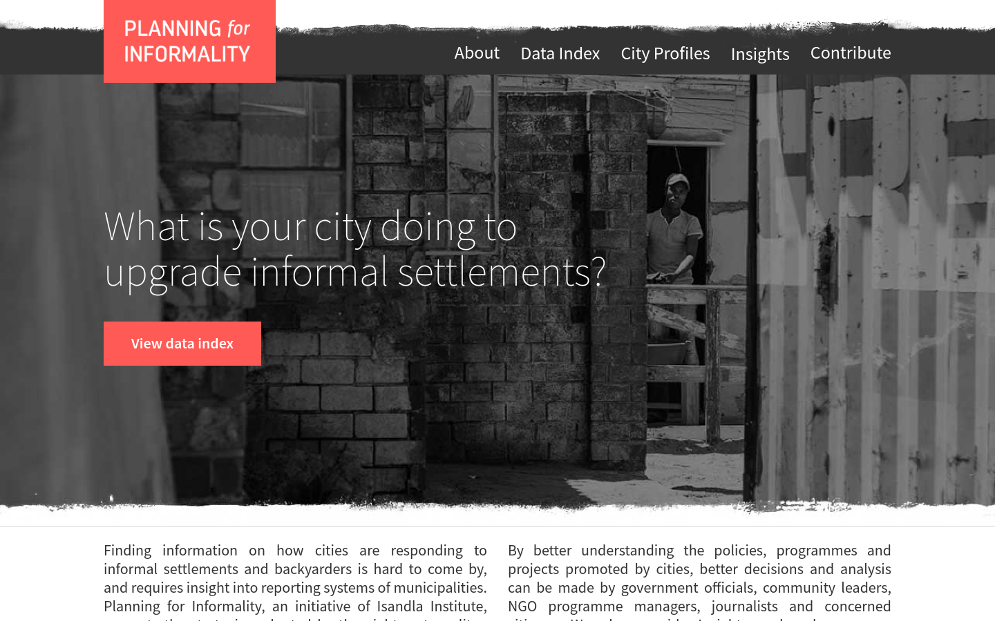
Planning for Informality
South Africa (South Africa, Afrika-Borwa, Suid-Afrika)What is your city doing to upgrade informal settlements?

PlanningAlerts
The OpenAustralia Foundation PO Box 147 Katoomba NSW 2780Find out for free what is being built and knocked down in your area and receive email alerts when something new is planned.

Planning 4 Informality
South Africa (South Africa, Afrika-Borwa, Suid-Afrika)Planning4Informality is a website which acts as 'policy tracker', datatool and accountability Platform. It was designed to measure and critically assess eight South African cities' response to national targets set to upgrade 750,000 out of the total 1.2 million informal households to standards outlined in stages 2 and 3 of the Upgrading of Informal Settlements Programme (UISP), part 3 of the National Housing Code. These cities are: Buffalo City, City of Cape Town, City of Joburg, City of Tshwane, Mangaung, eThekwini, Ekurhuleni, and Nelson Mandela Bay Metro. Open Data Durban partnered with Isandla Institute to create this living tracker that enables journalists, researchers, local government, communities, and many other user groups assess where each South African metro is at in terms of housing provision and upgrading informal settlements, supporting evidence-based decision making for city housing policy.

Planning Resource
The United Kingdom of Great Britain and Northern IrelandFind news, appeals decisions & best practice for development management & strategic planners on PlanningResource

The Planning London Datahub
LondonThe Planning DataHub is a collaborative project between all of the Planning Authorities in London to build a single open data set of development proposals in the planning process to enable monitoring of how our City is changing and develop a shared understanding of the data.

This repository contains curated list of different urban & regional planning data & technology resources. Those interested in the built environment are invited to review and contribute to this repository.


Sea Level Rise Planning Tool - New York City
New York CityThe tool provides Sea Level Rise Maps for New York City, integrating the best available FEMA flood hazard data for each location with information on future sea level rise from two different peer-reviewed sources.

The Metropolitan Area Planning Council is the regional planning agency serving the people who live and work in the 101 cities and towns of Metro Boston.

Block By Block Minecraft participatory planning workshops
UN Habitat, Beirut, LebanonDid you know that you can use Minecraft for more than a simple fun? Learn about great Block by Block initiative for community participation in urban design.


NYC Planning Labs
120 Broadway, New York, NY, USANYC Planning Labs builds open, impactful, modern technology tools for urban planners


Civic Engagement Microgrant Program
Arlington, VAMicrogrants of up to $3,000 will be awarded, on a rolling basis, to STEM groups led by master’s, PhD, postdoc, or professional students to design and execute projects that create dialogue with public officials, local community leaders, and the public around issues of common concern.

World Health Organization Innovation hub
Geneva, SwitzerlandWe use sustainable innovation to solve bottlenecks, accelerate impact, and improve health, focusing on the most neglected problems and people.

8-month pilot to test 12 computer-vision sensors across four boroughs of NYC to employ machine vision and improve street-level data collection and improve planning decisions

Equitable Community Engagement Toolkit
PhiladelphiaThe City of Philadelphia aims to improve collaboration with communities. This website shares guidance on how to engage communities equitably.
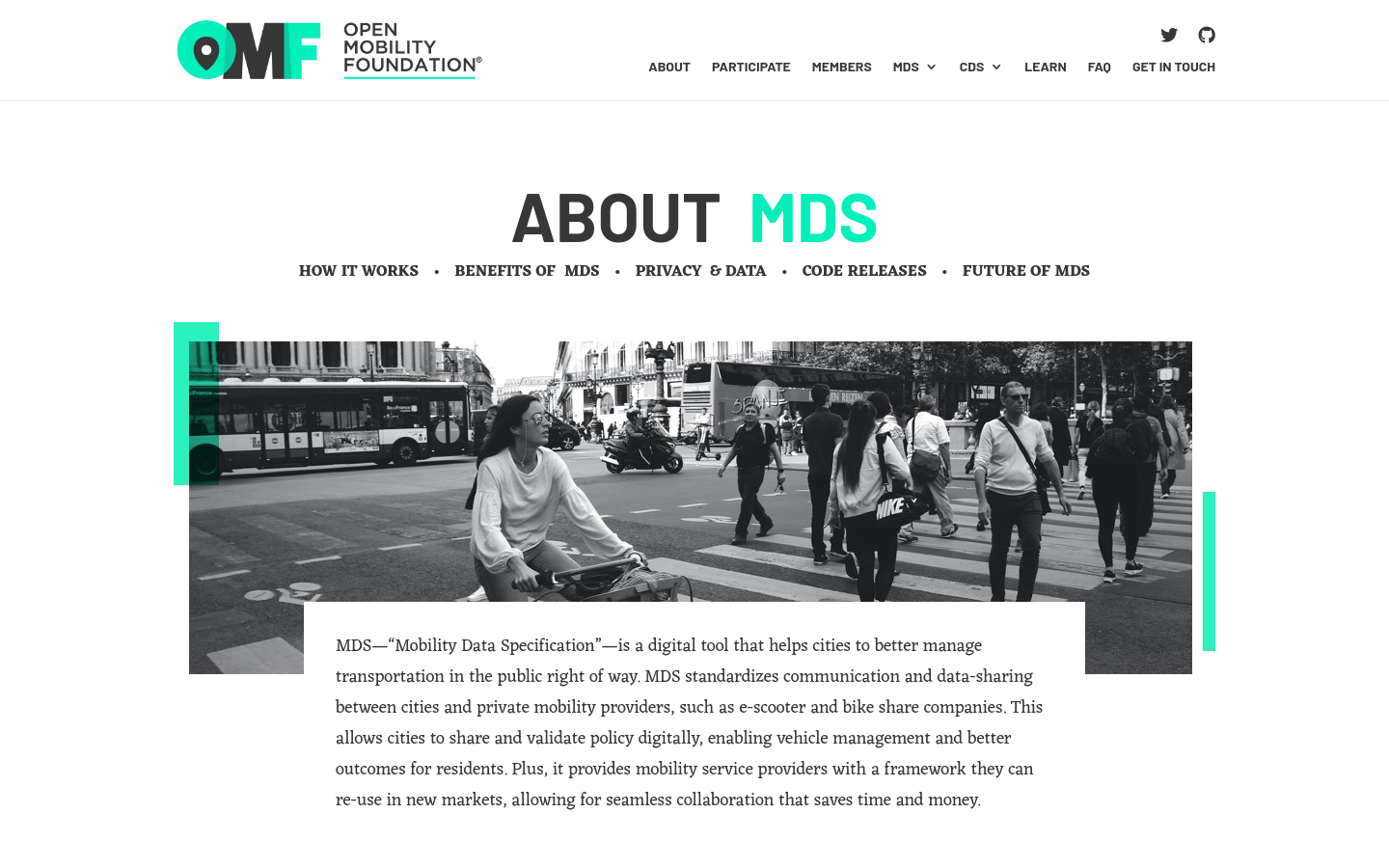
Mobility Data Specification (MDS)
United States of America (the)MDS standardizes communication and data-sharing between cities and private mobility providers, such as e-scooter and bike-share companies.

2020 UNDP initiative to assist the Republic of Vanuatu in the supervision of registration of electors and the planning and implementation of democratic elections for parliament, province, and municipal councils.

PlanIt
The United Kingdom of Great Britain and Northern IrelandUK PlanIt is a national aggregator for current and historical planning information.

Gobierto Contratación
Spain (España)Tools to improve public procurement processes for companies and public administration

Gobierto
Spain (España)Design of digital services for public administration with people and data at the center

Civic Infrastructure Collaborative
Chicago, ILCivic Infrastructure Collaborative drives public value from core urban infrastructure through cross-sector collaboration and technology-enabled innovation.

Tvarkau miestą
Lithuania (Lietuva)It is a platform aimed at improving the urban environment and public spaces in Lithuanian cities.

Citify
Lithuania (Lietuva)Citify is an online platform designed to track planned and existing real estate projects, ranging from apartment complexes and business centers to streets, bike paths, parks, and schools.

Kur Gyvenu
Lithuania (Lietuva)It's a platform aimed at helping people find information about various neighborhoods and districts in Lithuanian cities.

Brasil Participativo
Brazil (Brasil)Decidim platform for Brazil's national participatory process (2023)

Urban Platform
PortugalA web solution designed for governments that provides the digital twin of the city, and delivers a real-time view of every street, plus insightful analytics to support decision-making and increase the efficiency of the city operations.

Infrastructure Space
Manchester, United KingdomInfrastructure Space was established in 2017 to acknowledge the infrastructural turn in architectural theory, to embrace the thinking and methods established in L+U and [Re_Map] and to explore new territory, specifically the interface between digital communications, infrastructure and the production of space no longer limited to urban contexts, but accepting the often intangible manufactured nature of most British landscapes.

PowerLabs
United States of America (the)PowerLabs helps organizers design and run people-powered campaigns. We provide training, coaching and strategic planning support to build the capacity of organizations, leaders and networks.

We break the silos of urbanist practices to build Black power and Black joy.

Welcome Humanitarian Data & Digital Enthusiasts! Here You Can Find All Things Related To Data & Digital.

eCivis
800 Boylston Street, 16th Floor Boston, MA 02199eCivis helps state and local governments maximize grant funding, optimize financial and program performance, and prepare cost allocation plans.

A transportation operating system for orchestrating, governing, and powering modern mobility.

Tile2Net
United States of America (the)"an end-to-end open-source framework for creating georeferenced pedestrian networks from aerial imagery"

An open guide promoting participatory urban planning

Pushing the Boundaries of Scientific Innovation to Create a Smarter, Sustainable, and Resilient Future for Communities

“Seeing” Neighborhoods through “Big” Data
Boston, MAModern administrative data—from 311 and 911 calls to building permit applications to Tweets—offer a detailed view of events and conditions across the city.

Custodianship in the Urban Commons
Boston, MABARI has worked closely with the Mayor’s Office of New urban Mechanics and the 311 system examine how Bostonians contribute to the maintenance of the public spaces and infrastructure of neighborhoods—that is, custodianship in the urban commons.

Beirut Urban Observatory
Raymond Ghosn Building, American University of Beirut, Maroun Semaan Faculty of Engineering and Architecture PO Box. 11-0236 Riad El Solh 1107 2020, Beirut LebanonThe Beirut Urban Observatory is a platform of geolocalized urban data informing ongoing post-blast recovery efforts.

OECD Guidelines for Citizen Participation Processes
Paris, FranceThe OECD Guidelines for Citizen Participation Processes are intended for any public official or public institution interested in carrying out a citizen participation process.

OpenSidewalks
Seattle, WA, United States of AmericaOpenly mapping for the pedestrian experience.


OpenTripPlanner (OTP) is a family of open source software projects that provide passenger information and transportation network analysis services.

A digital twin solution for buildings and urban planning that works with Autodesk

ClearRoad
99 Wall Street NYClearRoad provides cloud-based solutions to keep roads well-maintained and well-managed Schedule a demo

Pulse Lab Jakarta
JakartaPulse Lab Jakarta is a joint data innovation facility of the United Nations (Global Pulse) and the Government of Indonesia (via the Ministry of National Development Planning, Bappenas).
Get email updates
Helpful Links
Reach Out
A project of

With support from
National Endowment for Democracy
Founding Organization
Civic Hall
Technology partner

 Civic Tech Field Guide